
As you’ve driven down I-94 to Medora for the last dozen or so years, you’ve seen a couple of yellow signs just inside the national park boundary fence a few miles east of Medora that say “Land for Sale.” Until I found out the story behind them, they gave me some pause. Hmmm. The park is selling off part of its land?
If you drive by there today, you’ll note the signs are still there, although a bit weathered. They probably won’t be there much longer, though, because the land’s been sold. But not by the park. Here’s the rest of the story.
Back in the mid-1960s, North Dakota Highway Commissioner Walter Hjelle was overseeing the completion of Interstate 94 through our state. At the time, the Interstate was about done, but the last stretch, a 40-mile section from just west of Belfield to the Montana border, was the last to be built.
At the time, where the “freeway” ended, traffic rerouted back onto U.S. Highway 10, a two-lane road, as it passed Theodore Roosevelt National Park on its way to Montana. To complete North Dakota’s freeway, a new route was drawn for the Interstate through the Bad Lands, and while the new highway generally followed the border of the South Unit of the National Park, it didn’t swerve around part of a ranch owned by Maurice O’Connell, a wealthy Dickinson banker, like the old two-lane highway had done.
In the days prior to the freeway, Old Highway 10, as it is known now, zigged north around O’Connell’s ranch land, to what was then the park entrance station a few miles east of Medora, and then zagged back southwest along the park boundary to Montana. (After the interstate was built, the entrance station was moved to Medora.)
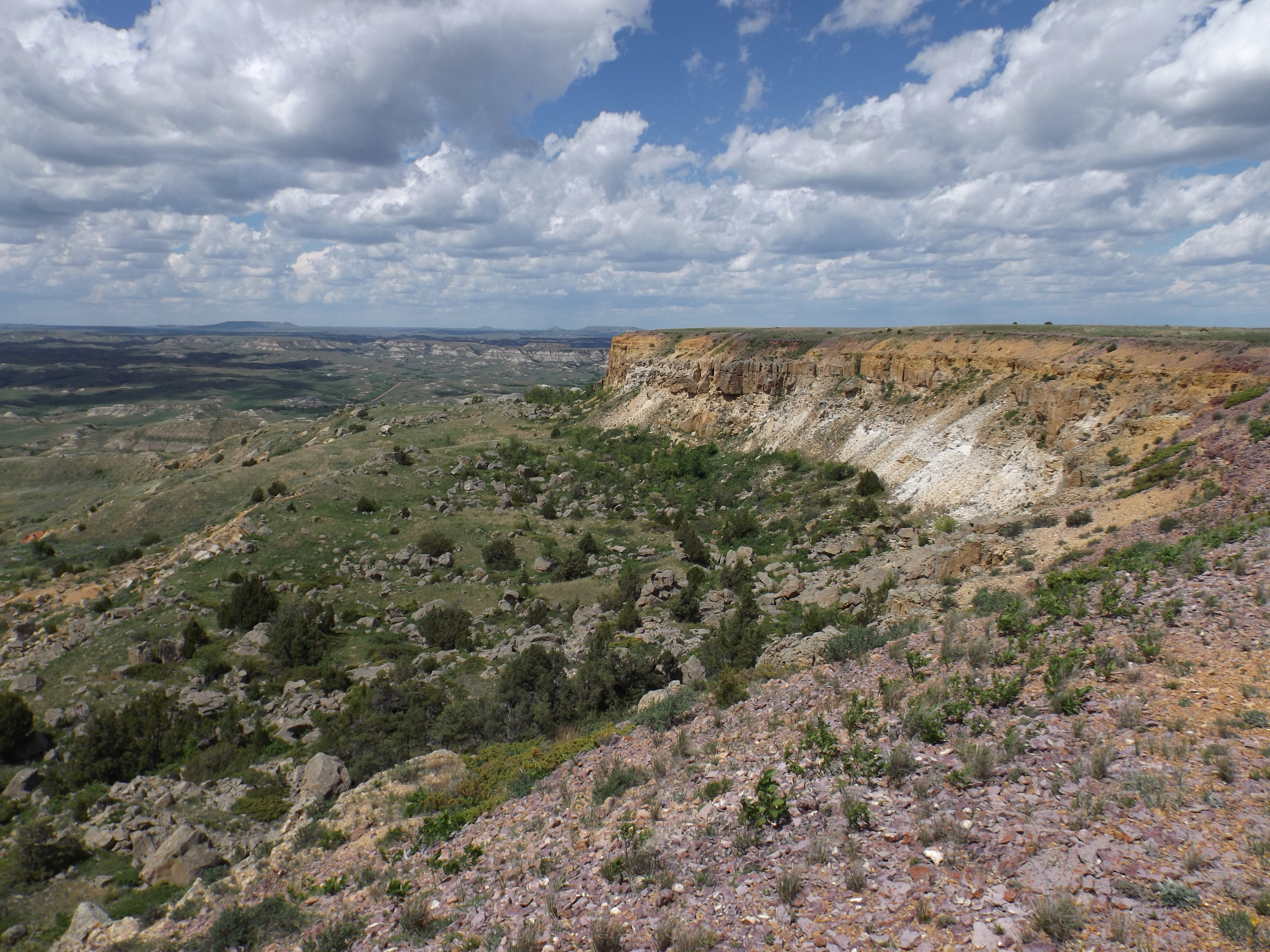
But the freeway builders wanted a straight shot to Montana instead of going around the O’Connell ranch. So they went right on through O’Connell’s ranch land. The result was a 220 acre “inholding” owned by O’Connell, which ended up inside the park fence, cut off by the new highway from the rest of O’Connell’s ranch on the south side of the road.
A couple of court cases ensued, and in the end, O’Connell just said, “Screw it,” and decided to hold on to the acreage, even though he had no way to access it. Eventually he donated it to a local church, and in 1982 the church sold it to a fellow named Norbert Sickler, a retired North Dakota Bureau of Criminal Investigation officer and prison administrator who, in retirement, dabbles in hospitality real estate in Medora. Sickler thought he might find a way to either develop it or sell it for a profit.
But it was of little use since there was no access to it except on foot or horseback from inside the park. The Park land (and Sickler’s land) is protected from the Interstate by a fence high enough to keep the park’s elk herd from jumping over it and getting hit by a semi on the freeway, and high enough to keep foolish tourists from climbing over it and getting gored by a bison bull. There’s a loop road through the park which comes within about half a mile of the Sickler land, and Sickler told me he parked his truck and horse trailer on the edge of the road and rode in there a couple of times. But otherwise, it just sat there and everyone assumed it was just a part of the park.
Until that day a dozen or so years ago, when those yellow signs appeared. But there were no takers, because the land was virtually useless with no access. Oh, the locals made jokes about a resort with a helicopter pad, but the signs just sat there, causing a lot of people to wonder about them as they drove by.
Originally Sickler had hoped to develop the land, and felt he should be able to get access to it from inside the National Park. He hired attorneys to look at the laws about that, but in the end he was unsuccessful. Then he tried to sell the land to the National Park. His asking price was about $600,000. But the National Park Service, by law, is not allowed to pay more than the appraised value of the land. According to a 2009 story in The Dickinson Press, the assessed value of the parcel for Billings County tax purposes then was about $12,000. Obviously Sickler felt, correctly, it was worth much more than that on the market.
There was a rumor that a nonprofit wildlife group once offered Sickler $300,000, and he turned it down. The county now has its value listed on its tax rolls this year at about $31,000. Billings County officials say that’s the value of similar agriculture land in the county. But I’m sure the fair market value is much greater than that.
And then along came a presidential library. A bunch of skilled businesspeople, fans of western history with an incredible knack for raising money, formed the Theodore Roosevelt Presidential Library Foundation. They found wealthy history buffs and oil magnates, raised about $150 million, and showed us plans to put a Presidential Library out on the prairie south of Medora. They might start moving dirt around and hauling in lumber as early as this summer.
The library foundation’s executives kept driving by the “For Sale” signs on the national park’s edge and got curious, so they called. They met Norbert Sickler and he took them for a walk on his property. And then, just a few weeks ago, in what Library officials say is a goodwill gesture, they decided to buy Norbert’s land.
In an e-mail to me last week, the Foundation’s CEO, Ed O’Keefe, said, “The Theodore Roosevelt Presidential Library Foundation has purchased the in-holding from Norbert, whom I have enjoyed getting to know the last few years. Norbert personally walked the in-holding with us last summer (including a visit from some curious park rangers!). As you state, I believe Norbert owned the parcel for over forty years and we are honored he chose to entrust us with these lands. We thank Norbert for his stewardship of the land and for his support of the Theodore Roosevelt Presidential Library.”
O’Keefe went on to say, “We are committed to the conservation legacy of Theodore Roosevelt. Our plan is to work with the National Park Service, Theodore Roosevelt National Park, and the National Park Foundation to ensure the land is not developed by outside parties and can be of best use to the Park, its mission, and ours. We are grateful TRPLF was able to make the purchase, protect the land, and be good partners to the Park.”
And so now, O’Keefe told me on the phone last week, the land is just going to be treated as part of the park. The Library folks have no plans to develop it. In the end, they might try to give it to the park, but, as we discussed on the phone, that’s not easy. It takes an act of Congress for the park to accept the land. But they might try.
O’Keefe told me how the sale came about. A wealthy conservation-minded donor gave a nice check to the Library Foundation. I didn’t ask him if it was for the entire $840,000 purchase price, but the price tag for the land, about $4,000 an acre, likely set a new record for Bad Lands real estate.
The Library Foundation then formed a for-profit company, called 23 Crossings, LLC (more about that name in a minute), and used the donor’s gift to buy the land. A grateful Sickler turned around and wrote a $250,000 check back to the non-profit Library Foundation, so in the end, Sickler ended up with just about the whole $600,000 he was originally seeking for the land. Everybody wins.
About that name 23 Crossings. It comes from a tale told by Clay Jenkinson in his historical guidebook Theodore Roosevelt in the Dakota Badlands (I haven’t been able to convince Clay to spell Bad Lands as two words yet, Like TR and I do, but I’m working on it). Clay’s the Theodore Roosevelt Humanities Scholar and founder of the Theodore Roosevelt Center just down the road from Medora at Dickinson State University. Clay wrote about TR bringing his wife Edith to the Bad Lands in 1890.
They were met at the train station in Medora by TR’s hired ranch hands, Clay writes, and they set out on the 35-mile ride to the Elkhorn Ranch, which is now part of Theodore Roosevelt National Park.
“The men rode horses to the Elkhorn ranch, and the ladies [Edith and TR’s sisters, Bamie and Corinne] sat in a horse-drawn wagon. They crossed the Little Missouri 23 times before they reached the ranch,” Clay wrote.
So now the land now appears to be safe from development, and, as far as the Library Foundation goes, it’s okay with them if it is just treated like the rest of the National Park land that surrounds it. I’m guessing even Maurice O’Connell would be happy about that.
So what happened to Maurice O’Connell after he gave his land to the church? Well, he’s been gone for a little more than 40 years. His story is one of the most gruesome tales ever told about western North Dakota. Here’s the short version.
On the night of March 15, 1983, a friendly, outgoing Dickinson junior high school teacher and coach, John Huber, loaded his ten-gauge shotgun and followed his wife and a man he believed to be her lover down a country road south of town, found them parked on a lonely approach, opened his car door, got out, and shot them both dead.
Then he got back in his car, drove back to town, went to the alleged lover’s home, and shot his wife. Then he went to his wife’s sister’s house and shot her. Then, covered in blood from four dead bodies, he drove to the Dickinson Police Department and turned himself in. All of that happened in just an hour’s time, between midnight and 1 a.m.
Huber was convicted of multiple murders and remains today in the North Dakota State Penitentiary in Bismarck, now nearing 80 years old. Next week he will celebrate his birthday behind bars for the 40th time. I doubt there will be cake.
The dead man was 53-year-old Maurice O’Connell. He left an $11 million estate to his children, including his ranch in the Bad Lands (less the 220 acres he gave away just a year earlier) and three banks, in Killdeer, New England and Dickinson. Through some bank mergers, ironically, I still have an account in the banks he owned.
The murderer, Huber, believed O’Connell was having an affair with Huber’s wife Gladys, from whom he had been separated for a few months. Gladys was a vice president at O’Connell’s bank. We’ll never know. Dead men (and women) tell no tales.
UPDATE APRIL 18, 2023: I’e been told by one of the actual participants in the previous offer I mentioned for the land that it was $400,000, not $300,000, and it wasn’t just a rumor–it actually happened. Sickler turned it down, and in the end got more than twice that–$840,000. Of course he gave $250,000 of it back to the Library Foundation. Still . . .

Another superb piece! Thanks.
LikeLike
This story could ONLY happen in North Dakota!
LikeLike
Jim,
Thanks for the column (blog, whatever that is) about the poor individuals that struggled through owning land in the Bad Lands, My heart sinks for them (jk).
As if justice meant nothing, the constraints on public lands are stupid. The Library Foundation would have had enough money to build all manor of first-class accommodations within TRNP and bring a ton of visitors into the park. for every year remaining in all people who read your story.
Once again, mystery solved though the mystery of Jim Fuglie!
Thanks again.
— j.c.balcom. 58554
LikeLike
Quite a story, Jim. I love the history. You are surely a master at research. All of your columns should be published in a book!
Keep writing!
Janie
LikeLike
Thank you, Janie. I’m happy to see you still staying involved in both history and current events. I hope our paths cross one of these days.
LikeLike
Great story Jim, thanks
LikeLike
Great story Jim, thanks, will buy you a few beers for this,
Steve
LikeLike
Hey, Steve, I’ll take a few. Thanks.
Jim Fuglie 920 Arthur Drive Bismarck, ND 58501 (701) 220-3492 jimfuglie920@gmail.com https://theprairieblog.com/ Badlands Watch-Dakota Country Magazine Follow me on Twitter @JimFuglie1
LikeLike
Great story, Jim! Have you thought of writing a book that contains some of your writing? This one shouldn’t be lost.
LikeLike
If not for you with your contacts and research, who would know the history of these 220 acres within the Bad Lands? I was gone from ND when the murders happened and had never heard about them until now. Sounds like a movie waiting to be produced.
LikeLike
So the seller effectively (both meanings!) ransomed the generous donor. Thankfully the government refused to pay up.
There is nothing special about the land for it to command a rate so far above market rates. The only difference is the THREAT of it being developed (or having ugly yellow signs on it for a decade). This threat was used to extract vast quantities of money. A literal ransoming!
I’ll give a big thumbs down to anyone who seeks to profit in such a manner.
Maybe the government should have taken it via eminent domain or similar process. Touchy subject on your blog lately, of course, but I would be interested to see a serious discussion around such an action.
LikeLike
Nah.
LikeLike